Randonnée Sports d'hiver Le Valtin - Gazon du Faing - Photo
 DanielROLLET
DanielROLLET

Utilisateur

© OpenStreetMap contributors
Longueur
Longueur
14,8 km
Altitude max
Altitude max
1238 m
Dénivelé positif
Dénivelé positif
264 m
Km-Effort
Km-Effort  
18,3 km
Altitude min
Altitude min
1134 m
Dénivelé négatif
Dénivelé négatif
269 m
Boucle
Boucle
Oui
Date de création :
2016-05-27 00:00:00.0
Dernière modification :
2021-01-10 08:22:35.443

(0 Avis)

Sports d'hiver
Sports d'hiver
2h28
Difficulté : Facile

Scannez ce code QR pour ouvrir la randonnée dans l'application SityTrail

Application GPS de randonnée GRATUITE

Logo SityTrail SityTrail

IGN / Instituts géographiques

Télécharger SityTrail sur l'App Store Télécharger SityTrail sur Google Play

Logo SityTrail SityTrail World

Le monde est à vous

Télécharger SityTrail sur l'App Store Télécharger SityTrail sur Google Play Télécharger SityTrail sur Huawei AppGallery

À propos

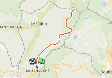
Randonnée Sports d'hiver de 14,8 km à découvrir à Grand Est, Vosges, Le Valtin. Cette randonnée est proposée par DanielROLLET.

Description

2016 03 26 avec Marie
Gazon du Faing
AR depuis col de la Schlucht

Profil altimétrique

Points d'intérêt

Point d'intérêt Le Valtin - gazon du faingPoint 1 - Photo
DanielROLLET

Localisation

Pays :
France
Région :
Grand Est
Département/Province :
Vosges
Commune :
Le Valtin
Localité :
Unknown
Départ:(Dec)
Départ:(UTM)
352655 ; 5325522 (32U) N.

Randonnées à proximité

Randonnée Marche Stosswihr - Tour du belvedere avec le passage sur les crêtes  - Photo
Marche
ocepee

Marche

Très facile
(2)
Stosswihr, Grand Est, Haut-Rhin, France
8,5 km | 0 m-effort
2h 28min
Oui
Randonnée Autre activité Soultzeren - Totom 4 lacs - Photo
Autre activité
dinozore

Autre activité

Moyen
(1)
Soultzeren, Grand Est, Haut-Rhin, France
15,6 km | 26 km-effort
4h 37min
Oui
Randonnée Marche La Bresse - Les 5 lacs autour du Hohneck - Photo
Marche
tiene

Marche

Très difficile
(1)
La Bresse, Grand Est, Vosges, France
21 km | 36 km-effort
7h 21min
Oui
Randonnée Marche Le Valtin - Les Hirschsteine - Photo
Marche
VacheKiri67

Marche

Difficile
(1)
Le Valtin, Grand Est, Vosges, France
16,1 km | 25 km-effort
6h 28min
Oui
Randonnée Marche Ban-sur-Meurthe-Clefcy - La vallée de Belbriette - Ban-sur-Meurthe-Clefcy - Photo
Marche
tracegps

Marche

Moyen
(2)
Ban-sur-Meurthe-Clefcy, Grand Est, Vosges, France
9,8 km | 12,6 km-effort
2h 30min
Oui
Randonnée Marche La Bresse - Du Hohneck au Kastelberg par les Spietzkoepfe et le Sentier des Névées - Photo
Marche
tracegps

Marche

Très difficile
(3)
La Bresse, Grand Est, Vosges, France
7,6 km | 13,7 km-effort
3h 30min
Oui
Randonnée Marche Soultzeren - Tanet-Gazon du faing par lac vert et retour sommet du Tanet - Photo
Marche
ride-in-Elsass

Marche

Moyen
(1)
Soultzeren, Grand Est, Haut-Rhin, France
10 km | 15,6 km-effort
4h 24min
Oui
Randonnée Raquettes à neige Le Valtin - raquettes  - Photo
Raquettes à neige
vathi54

Raquettes à neige

Très facile
(1)
Le Valtin, Grand Est, Vosges, France
6,6 km | 9,4 km-effort
3h 8min
Non
Randonnée Marche Stosswihr - Le cirque glaciaire du Frankenthal - Sentier des Roches -Gps - Photo
Marche
GUIDE
Desrumaux

Marche

Difficile
(3)
Stosswihr, Grand Est, Haut-Rhin, France
9 km | 16,1 km-effort
4h 10min
Oui


Fermer
Mes abonnements